
Action Items
This page organizes Eagle County’s action items for areas of recommended landscape scale vegetation management projects from the CWPP.

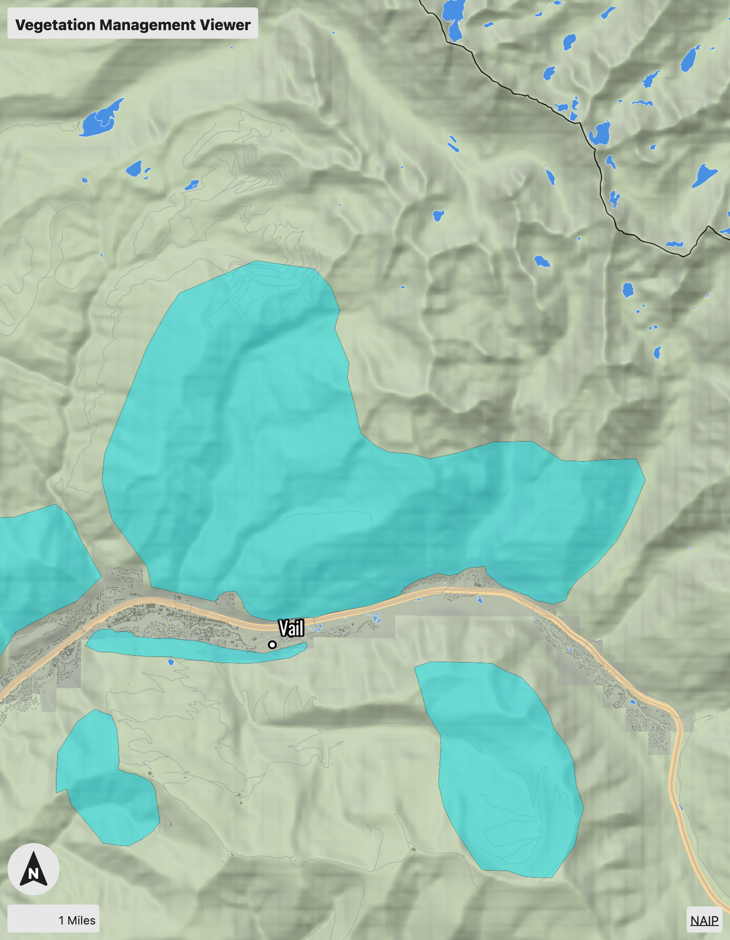
Lower Gore Creek
Project Area Description
The lower Gore Creek treatment area includes the area from the ridge line north of Dowd Junction east to FS road 700. Interstate 70 and the developed private property from the southeast or downhill boundary and uphill boundary is the lower extent of previous treatments off FS rd. 700 and FS rd. 734. Primary ownership within this treatment area is USFS; however, portions of the treatment area are private and state ownership. The treatment area contains several areas of critical infrastructure including transmission power lines and communications towers.
Treatment Goals
The goals of this treatment area are:
Protect ecosystems and natural resources from high intensity wildfires.
Protect critical infrastructure from high intensity wildfires.
Create wildfire resilient landscapes
Preferred Treatment Method
Multiple treatment methods will be necessary to accomplish the stated objectives. Below are the preferred treatment methods:
Treatment 1 — Priority: High In Progress
Use hand treatments to create linked defensible space for all structures along the downhill boundary of the treatment area. These treatments should extend from the structure to an area at least 100 feet wide.
Treatment 2 — Priority: Moderate Planned
Use a combination of hand treatments and mechanical harvest to implement point protection for critical infrastructure. Specific prescriptions for point protection should decrease potential fire behavior below thresholds that would damage infrastructure (i.e. flame length less than 3 feet within 100 feet of the infrastructure).
Treatment 3 — Priority: Moderate Completed
Reintroduce fire onto the landscape through the use of prescribed fire.
Middle Gore Creek
Project Area Description
The Middle Gore Creek treatment area includes the area from FS road 700 to the Pitkin Creek Drainage. Interstate 70 and the developed private property form the southern or downhill boundary. The treatment area covers the lower reaches of the Middle Creek, Spraddle Creek, Booth Creek and Pitkin Creek drainages. Primary ownership within this treatment area is USFS however portions of the treatment area are private and municipal ownership. The eastern portion of the treatment area overlaps with the boundary of the Eagles Nest Wilderness Area. The treatment area contains several areas of critical infrastructure including transmission power lines and communications towers.
Treatment Goals
The goals of this treatment area are:
1. Reduce high intensity fire behavior within 100 feet of structures.
2. Protect ecosystems and natural resources from high intensity wildfires.
3. Create wildfire resilient landscapes.
4. Decrease potential ignition sources by improving existing power infrastructure.
Preferred Treatment Method
Multiple treatment methods will be necessary to accomplish the stated objectives. Below are the preferred treatment methods:
Treatment 1 — Priority: High In Progress
Use hand treatments to create linked defensible space for all structures along the downhill boundary of the treatment area. These treatments should extend from the structure to an area at least 100 feet wide.
Treatment 2 — Priority: Moderate Planned
Reintroduce fire onto the landscape through the use of prescribed fire.
Treatment 3 — Priority: High Completed
Prioritize the undergrounding of above-ground power distribution lines between the Spraddle Creek subdivision and Bald Mountain Road.
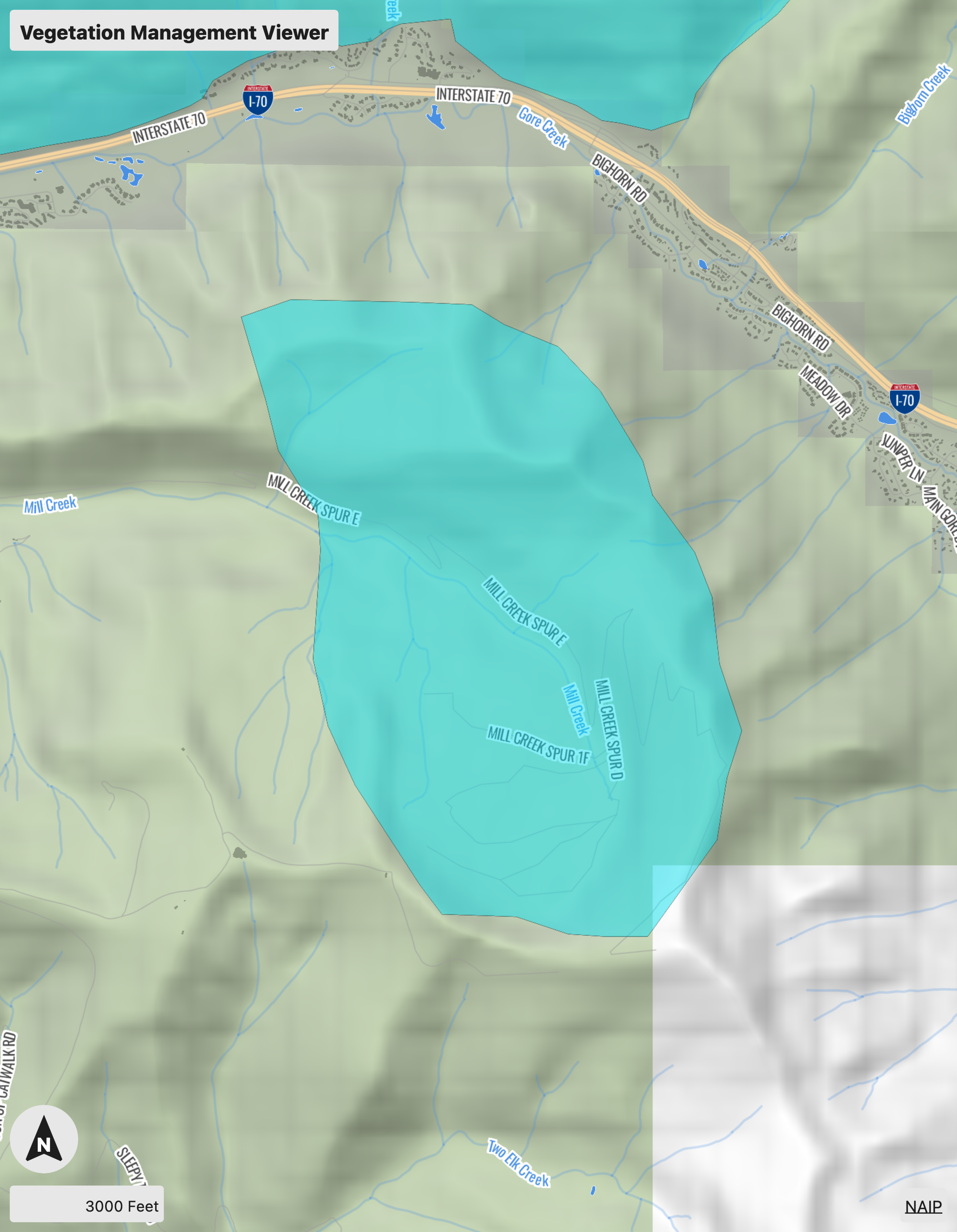
Benchmark and Mushroom Bowl
Project Area Description
The Benchmark/ Mushroom Bowl treatment area includes all the area in the upper reaches of the Mill Creek Drainage. The area is commonly referred to as Benchmark or the Mushroom Bowl. The area is accessed via Benchmark Road. Primary ownership within this treatment area is USFS.
Treatment Goals
The goals of this treatment area are:
1. Create operational delineations on the landscape to decrease resistance to control for fires burning within Benchmark or the East Vail Chutes.
2. Reduce high intensity fire behavior along the ridgeline between Benchmark and the East Vail Chutes.
3. Protect critical infrastructure from high intensity wildfires.
Preferred Treatment Method
Treatment 1 — Priority: Moderate In Progress
Use a combination of commercial timber harvest, hand treatments, and prescribed fire to create and maintain openings along the northern or eastern treatment area boundaries. Pockets of dead or diseased trees should be removed throughout the treatment area to decrease fire intensity and create potential operational delineations for fire suppression.
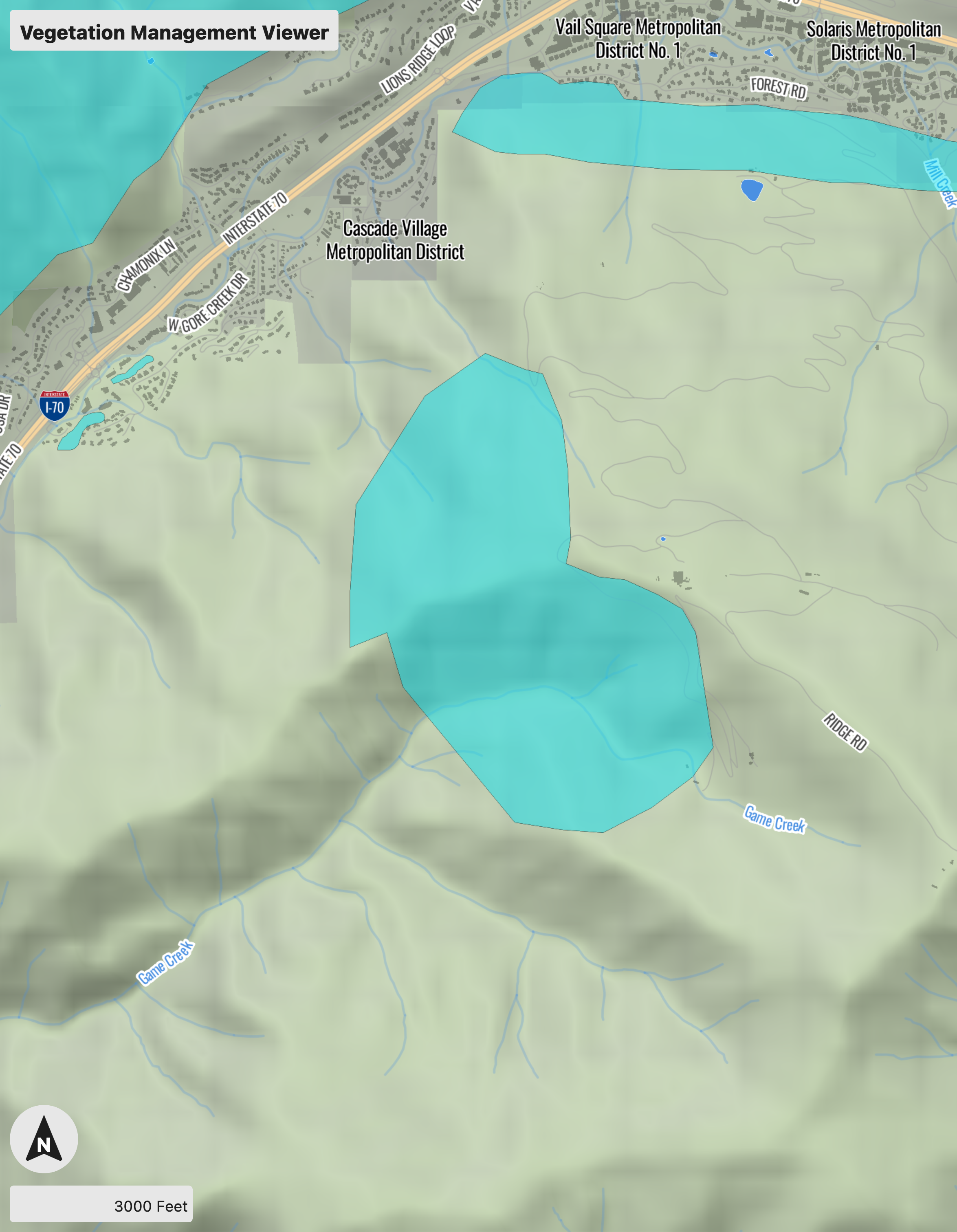
Eagles Nest and Lower Game Creek
Project Area Description
The Eagles Nest/ Lower Game Creek treatment area includes the area west of the Vail Ski Area Boundary from the Cascade Lift on the north over the top of the ridge to the drainage below the Game Creek Bowl. Primary ownership within this treatment area is USFS. The treatment area contains several areas of critical infrastructure including recreational ski infrastructure and communications sites. The area immediately east of the treatment area is a highly used developed recreation site for summer recreation activities. The Eagle Bahn Gondola which runs along the eastern edge of the treatment area is the primary evacuation method for moving guests from the mountain to safety in the village.
Treatment Goal
The goals of this treatment area are:
1. Protect critical infrastructure and recreational facilities from high intensity wildfire.
2. Create compartmentalization on landscape.
3. Protect primary evacuation route - reduce risk of wildfire disaster.
Preferred Treatment Method
Multiple treatment methods will be necessary to accomplish the stated objectives. Below are the preferred treatment methods:
Treatment 1 — Priority: High Planned
Use a combination of commercial timber harvest and hand treatments to create and maintain openings throughout the treatment area boundaries.
Treatment 2 — Priority: High In Progress
Use a combination of hand treatments and mechanical harvest to implement point protection for critical infrastructure. Specific prescriptions for point protection should decrease potential fire behavior below thresholds that would damage infrastructure (i.e. flame length less than 3 feet within 100 feet of the infrastructure).
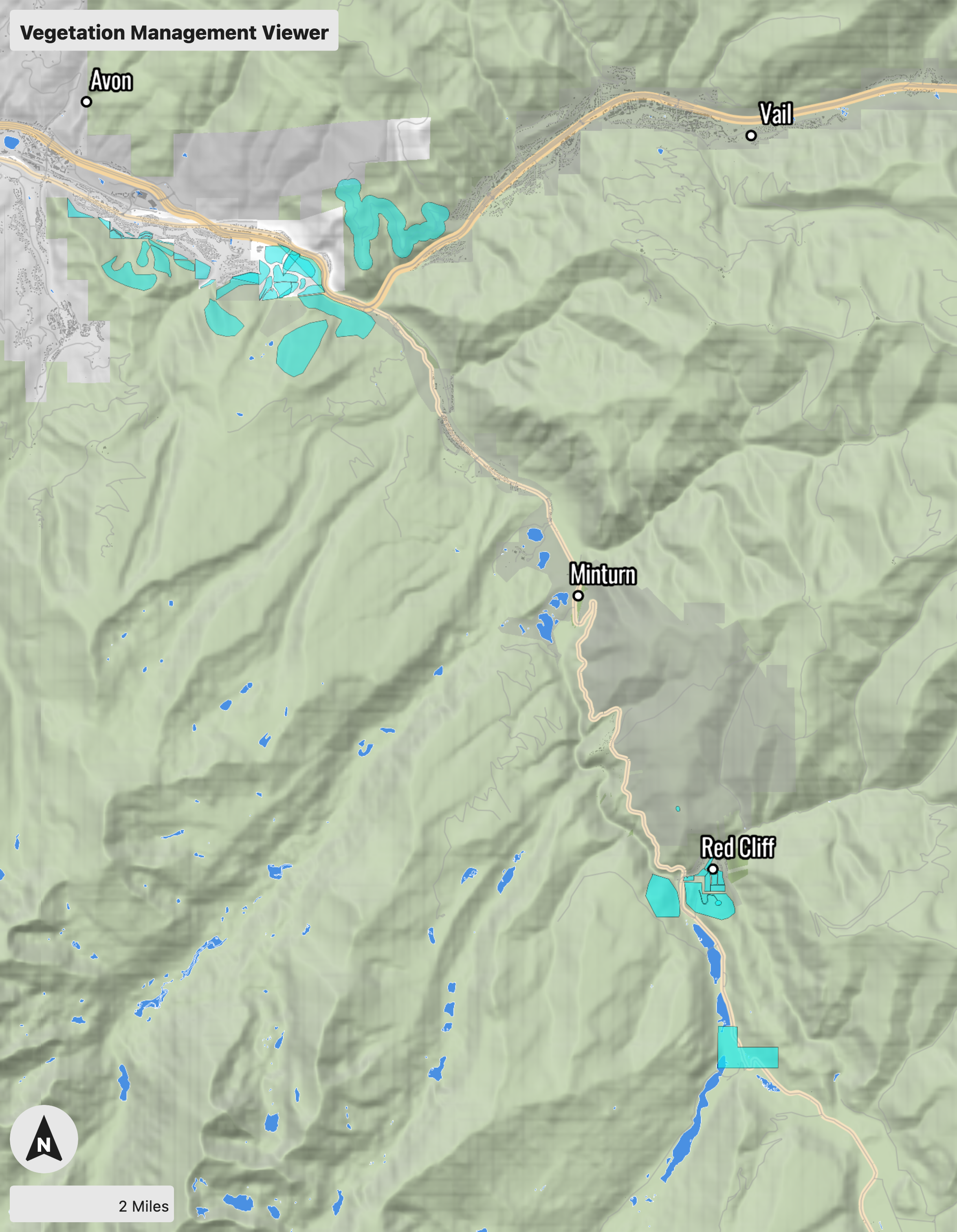
Highway 24
Project Area Description
The Highway 24 treatment area encompasses the area along the Highway 24 corridor, including Minturn, Red Cliff, Tennessee Pass, recreation areas off of Tigiwon and Shrine Pass Roads (among others), and areas that are slated to be developed in the Battle Mountain area. The intersection with Interstate 70 and Highway 24 is the southern boundary. Primary ownership within this treatment area is USFS; however, portions of the treatment area are private and state ownership. The treatment area contains several areas of critical infrastructure including transmission power lines, communications towers, a major highway and bridge, water pipelines, water intake and storage facilities, railroad, and a small ski area.
Treatment Goal
The goals of this treatment area are:
1. Protect ecosystems and natural resources from high intensity wildfires.
2. Protect critical infrastructure from high intensity wildfires.
3. Create wildfire resilient landscapes.
4. Improve the strategic and tactical viability of the USFS/BLM Potential Operational Delineations (PODS) by treating highly flammable fuels along boundaries.
5. Improve the effectiveness of existing and future WUI fuels projects by treating both sides of public/private land boundaries.
Preferred Treatment Method
Multiple treatment methods will be necessary to accomplish the stated objectives. Below are the preferred treatment methods:
Treatment 1 — Priority: High Planned
Use mastication to create linked fuel breaks and fuels reduction units for all areas of population concentration and infrastructure assets. Specific prescriptions for fuels reduction projects should decrease potential fire behavior below thresholds that would damage infrastructure (i.e. flame length less than 3 feet).
Treatment 2 — Priority: High In Progress
Use hand thinning to selectively thin (reduce fuel loading to appropriate levels given the vegetation type and growth patterns) and create linked fuel breaks and fuels reduction units around areas of population concentrations and infrastructure assets. Specific prescriptions for fuels reduction projects should decrease potential fire behavior below thresholds that would damage infrastructure (i.e. flame length less than 3 feet).
Treatment 3 — Priority: High Completed
Re-introduce low-intensity fire onto the landscape through the use of prescribed fire to reduce heavy fuel loading and reinstate ecologically appropriate fire return intervals.
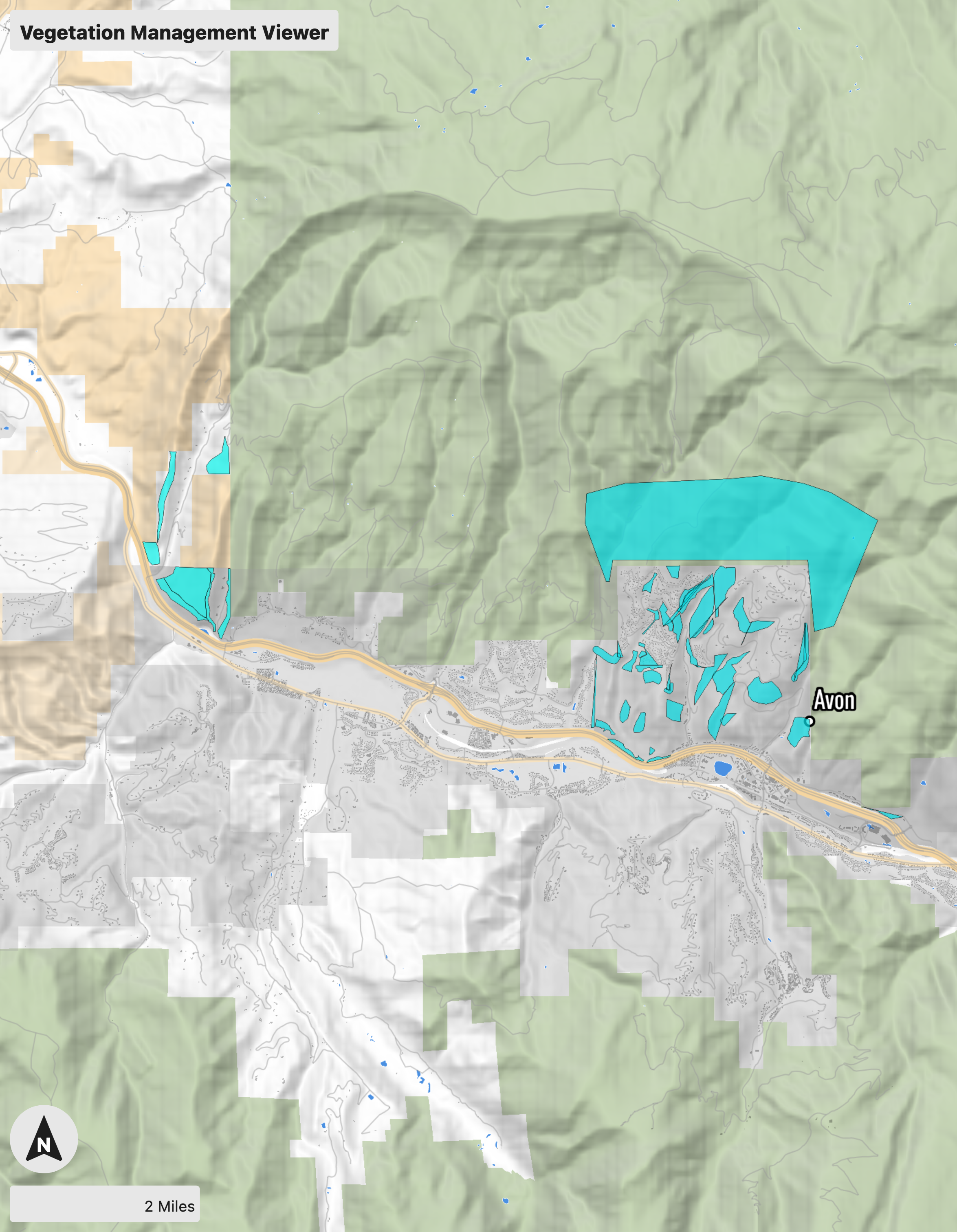
Mid-Valley North
Project Area Description
Mid-Valley North encompasses areas in Avon and Edwards north of I-70, including the Cordillera Valley Club, Singletree, Wildwood, Wildridge, and Mountain Star sub-divisions. Primary ownership within this treatment area is private or owned by metro districts or HOA’s; however, portions of the treatment area are USFS, BLM, and state ownership. The treatment area contains some areas of critical infrastructure including transmission power lines, communications towers, and recreation assets.
Treatment Goal
The goals of this treatment area are:
1. Protect ecosystems and natural resources from high intensity wildfires.
2. Protect critical infrastructure from high intensity wildfires.
3. Create wildfire resilient landscapes.
4. Create resilient wildlife populations by maintaining healthy ecosystems and habitat connectivity.
5. Improve the strategic and tactical viability of the USFS/BLM Potential Operational Delineations (PODS) by treating highly flammable fuels along boundaries.
6. Improve the effectiveness of existing and future WUI fuels projects by treating both sides of public/private land boundaries.
Preferred Treatment Method
Multiple treatment methods will be necessary to accomplish the stated objectives. Below are the preferred treatment methods:
Treatment 1 — Priority: High Planned
Use mastication to create linked fuel breaks and fuels reduction units for all areas of population concentration and infrastructure assets. Specific prescriptions for fuels reduction projects should decrease potential fire behavior below thresholds that would damage infrastructure (i.e. flame length less than 3 feet).
Treatment 2 — Priority: High In Progress
Use hand thinning to selectively thin (reduce fuel loading to appropriate levels given the vegetation type and growth patterns) and create linked fuel breaks and fuels reduction units around areas of population concentrations and infrastructure assets. Specific prescriptions for fuels reduction projects should decrease potential fire behavior below thresholds that would damage infrastructure (i.e. flame length less than 3 feet).
Treatment 3 — Priority: High Completed
Re-introduce low-intensity fire onto the landscape through the use of prescribed fire to reduce heavy fuel loading and reinstate ecologically appropriate fire return intervals.

Mid-Valley South
Project Area Description
Mid-Valley South encompasses areas in Avon and Edwards south of I-70, including Lake Creak, Creamery Ranch, Homestead, and the Cordillera, Arrowhead, Bachelor Gulch, and Beaver Creek Metro Districts. Primary ownership within this treatment area is USFS; however, portions of the treatment area are private and state ownership. The treatment area contains several areas of critical infrastructure including transmission power lines, communications towers, a major highway, water intake and storage facilities, and ski areas (with their accompanying infrastructure).
Treatment Goal
The goals of this treatment area are:
1. Protect ecosystems and natural resources from high intensity wildfires.
2. Protect critical infrastructure from high intensity wildfires.
3. Create wildfire resilient landscapes.
4. Improve the strategic and tactical viability of the USFS/BLM Potential Operational Delineations (PODS) by treating highly flammable fuels along boundaries.
5. Improve the effectiveness of existing and future WUI fuels projects by treating both sides of public/private land boundaries.
Preferred Treatment Method
Multiple treatment methods will be necessary to accomplish the stated objectives. Below are the preferred treatment methods:
Treatment 1 — Priority: High Planned
Use mastication to create linked fuel breaks and fuels reduction units for all areas of population concentration and infrastructure assets. Specific prescriptions for fuels reduction projects should decrease potential fire behavior below thresholds that would damage infrastructure (i.e. flame length less than 3 feet).
Treatment 2 — Priority: High In Progress
Use hand thinning to selectively thin (reduce fuel loading to appropriate levels given the vegetation type and growth patterns) and create linked fuel breaks and fuels reduction units around areas of population concentrations and infrastructure assets. Specific prescriptions for fuels reduction projects should decrease potential fire behavior below thresholds that would damage infrastructure (i.e. flame length less than 3 feet).
Treatment 3 — Priority: High Completed
Re-introduce low-intensity fire onto the landscape through the use of prescribed fire to reduce heavy fuel loading and reinstate ecologically appropriate fire return intervals.
Wolcott
Project Area Description
Encompasses the area around Wolcott, including Red Sky Ranch, Diamond Star, Bellyache Ridge, and public and private land along Highway 131 to McCoy (Horse Mountain Ranch, Muddy Pass, Milk Creek, and Alkali Creek Roads). Primary ownership within this treatment area is BLM; however, portions of the treatment area are private and state ownership. The treatment area contains some areas of critical infrastructure including transmission power lines, communications towers, and recreation assets.
Treatment Goal
The goals of this treatment area are:
1. Protect ecosystems and natural resources from high intensity wildfires.
2. Protect critical infrastructure from high intensity wildfires.
3. Create wildfire resilient landscapes.
4. Create resilient wildlife populations by maintaining healthy ecosystems and habitat connectivity.
5. Improve the strategic and tactical viability of the USFS/BLM Potential Operational Delineations (PODS) by treating highly flammable fuels along boundaries.
6. Improve the effectiveness of existing and future WUI fuels projects by treating both sides of public/private land boundaries.
Preferred Treatment Method
Multiple treatment methods will be necessary to accomplish the stated objectives. Below are the preferred treatment methods:
Treatment 1 — Priority: High Planned
Use mastication to create linked fuel breaks and fuels reduction units for all areas of population concentration and infrastructure assets. Specific prescriptions for fuels reduction projects should decrease potential fire behavior below thresholds that would damage infrastructure (i.e. flame length less than 3 feet).
Treatment 2 — Priority: High In Progress
Use hand thinning to selectively thin (reduce fuel loading to appropriate levels given the vegetation type and growth patterns) and create linked fuel breaks and fuels reduction units around areas of population concentrations and infrastructure assets. Specific prescriptions for fuels reduction projects should decrease potential fire behavior below thresholds that would damage infrastructure (i.e. flame length less than 3 feet).
Treatment 3 — Priority: High Completed
Re-introduce low-intensity fire onto the landscape through the use of prescribed fire to reduce heavy fuel loading and reinstate ecologically appropriate fire return intervals.

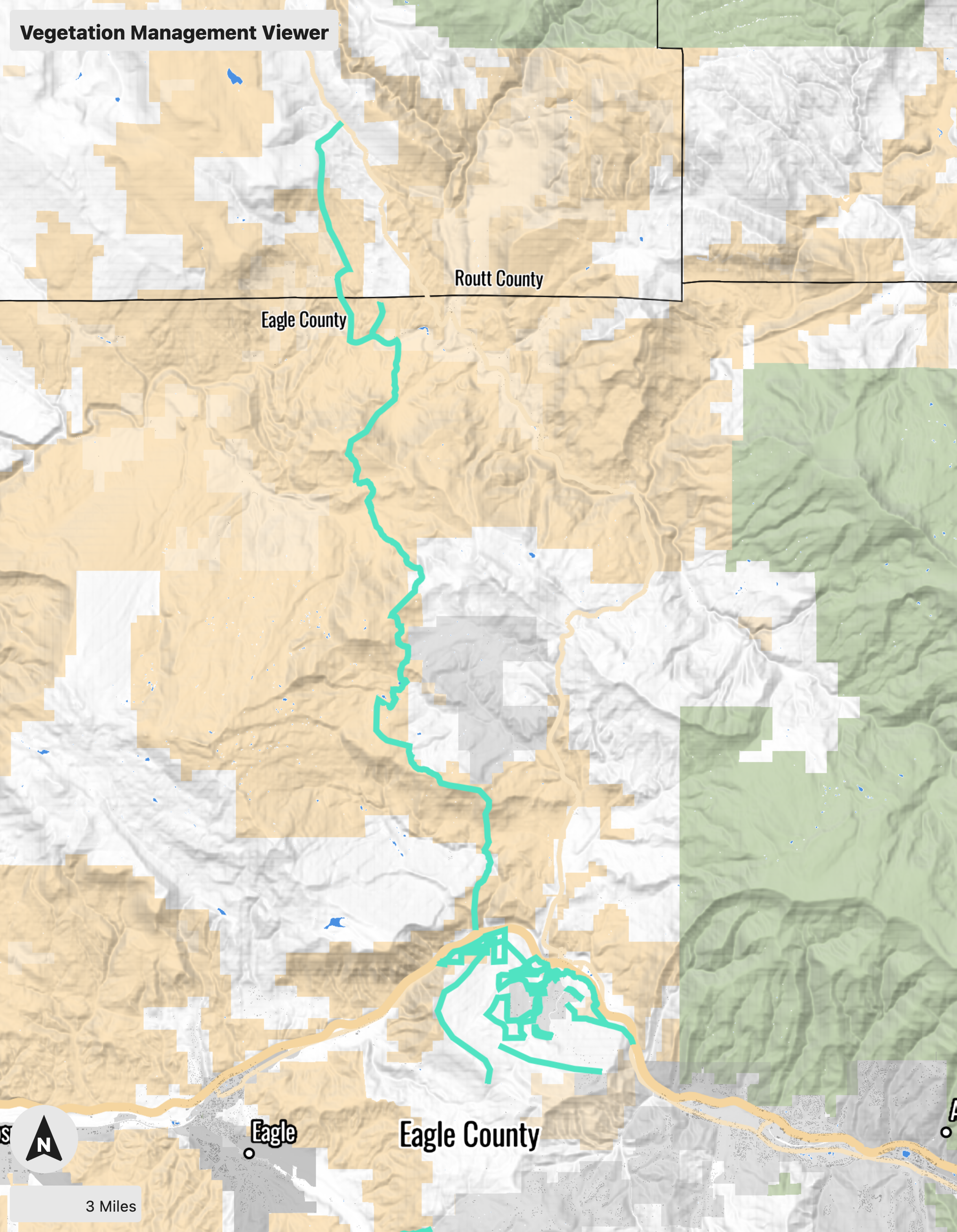
Eagle
Project Area Description
This area encompasses Eagle and outlying areas, including the Brush Creek Valley, Eagle Ranch, Eby Creek, Upper Kaibab, Frost Creek, the Salt Creek and Bruce Creek drainages, and Sylvan Lake State Park. Primary ownership within this treatment area is private or HOA; however, portions of the treatment area are Town of Eagle, state, BLM, or USFS ownership. The treatment area contains several areas of critical infrastructure including transmission power lines, communications towers, water storage facilities, and recreation assets.
Treatment Goal
The goals of this treatment area are:
1. Protect ecosystems and natural resources from high intensity wildfires.
2. Protect critical water sources and infrastructure from high intensity wildfires.
3. Create wildfire resilient landscapes.
4. Improve the strategic and tactical viability of the USFS/BLM Potential Operational Delineations (PODS) by treating highly flammable fuels along boundaries.
5. Improve the effectiveness of existing and future WUI fuels projects by treating both sides of public/private land boundaries.
Preferred Treatment Method
Multiple treatment methods will be necessary to accomplish the stated objectives. Below are the preferred treatment methods:
Treatment 1 — Priority: High Planned
Use mastication to create linked fuel breaks and fuels reduction units for all areas of population concentration and infrastructure assets. Specific prescriptions for fuels reduction projects should decrease potential fire behavior below thresholds that would damage infrastructure (i.e. flame length less than 3 feet).
Treatment 2 — Priority: High In Progress
Use hand thinning to selectively thin (reduce fuel loading to appropriate levels given the vegetation type and growth patterns) and create linked fuel breaks and fuels reduction units around areas of population concentrations and infrastructure assets. Specific prescriptions for fuels reduction projects should decrease potential fire behavior below thresholds that would damage infrastructure (i.e. flame length less than 3 feet).
Treatment 3 — Priority: High Completed
Re-introduce low-intensity fire onto the landscape through the use of prescribed fire to reduce heavy fuel loading and reinstate ecologically appropriate fire return intervals.

Gypsum North
Project Area Description
The Gypsum North area encompasses private and federally managed lands in the areas off the Colorado River Road and Trail Gulch Road, and the Burns, Sweetwater, and Derby Mesa communities. Primary ownership within this treatment area is BLM; however, portions of the treatment area are private and state ownership. The treatment area contains several areas of critical infrastructure including transmission power lines, communications towers, recreation assets, and railroad infrastructure.
Treatment Goal
The goals of this treatment area are:
1. Protect ecosystems and natural resources from high intensity wildfires.
2. Protect critical infrastructure from high intensity wildfires.
3. Create wildfire resilient landscapes.
4. Improve the strategic and tactical viability of the USFS/BLM Potential Operational Delineations (PODS) by treating highly flammable fuels along boundaries.
5. Improve the effectiveness of existing and future WUI fuels projects by treating both sides of public/private land boundaries.
Preferred Treatment Method
Multiple treatment methods will be necessary to accomplish the stated objectives. Below are the preferred treatment methods:
Treatment 1 — Priority: High Planned
Use mastication to create linked fuel breaks and fuels reduction units for all areas of population concentration and infrastructure assets. Specific prescriptions for fuels reduction projects should decrease potential fire behavior below thresholds that would damage infrastructure (i.e. flame length less than 3 feet).
Treatment 2 — Priority: High In Progress
Use hand thinning to selectively thin (reduce fuel loading to appropriate levels given the vegetation type and growth patterns) and create linked fuel breaks and fuels reduction units around areas of population concentrations and infrastructure assets. Specific prescriptions for fuels reduction projects should decrease potential fire behavior below thresholds that would damage infrastructure (i.e. flame length less than 3 feet).
Treatment 3 — Priority: High Completed
Re-introduce low-intensity fire onto the landscape through the use of prescribed fire to reduce heavy fuel loading and reinstate ecologically appropriate fire return intervals.

Gypsum South
Project Area Description
The Gypsum South area encompasses Gypsum, the Eagle County Airport, Airport Industrial Park, Chatfield Corners, Brightwater, Spring Valley, and public and private lands in the Gypsum Creek drainage. Ownership within this treatment area is a mix of USFS, BLM, state, and private lands. The treatment area contains several areas of critical infrastructure including transmission power lines, communications towers, water sources for the town of Gypsum, water pipelines, water intake and storage facilities, and recreation assets.
Treatment Goal
The goals of this treatment area are:
1. Protect ecosystems and natural resources from high intensity wildfires.
2. Protect critical water sources and infrastructure from high intensity wildfires.
3. Create wildfire resilient landscapes.
4. Improve the strategic and tactical viability of the USFS/BLM Potential Operational Delineations (PODS) by treating highly flammable fuels along boundaries.
5. Improve the effectiveness of existing and future WUI fuels projects by treating both sides of public/private land boundaries.
Preferred Treatment Method
Multiple treatment methods will be necessary to accomplish the stated objectives. Below are the preferred treatment methods:
Treatment 1 — Priority: High Planned
Use mastication to create linked fuel breaks and fuels reduction units for all areas of population concentration and infrastructure assets. Specific prescriptions for fuels reduction projects should decrease potential fire behavior below thresholds that would damage infrastructure (i.e. flame length less than 3 feet).
Treatment 2 — Priority: High In Progress
Use hand thinning to selectively thin (reduce fuel loading to appropriate levels given the vegetation type and growth patterns) and create linked fuel breaks and fuels reduction units around areas of population concentrations and infrastructure assets. Specific prescriptions for fuels reduction projects should decrease potential fire behavior below thresholds that would damage infrastructure (i.e. flame length less than 3 feet).
Treatment 3 — Priority: High Completed
Re-introduce low-intensity fire onto the landscape through the use of prescribed fire to reduce heavy fuel loading and reinstate ecologically appropriate fire return intervals, particularly in the Gypsum Creek watershed.

Roaring Fork
Project Area Description
Missouri Heights is a large residential area located on the mesa above El Jebel and the Highway 82 corridor. The area can be accessed from Highway 82 via El Jebel Road which becomes Upper Cattle Creek Road as it travels through Missouri Heights, or from Garfield County via County Road 102 which becomes Fender Lane. The Town of Basalt is located along State Highway 82, and at the confluence of the Frying Pan and Roaring Fork rivers. The Ruedi Reservoir is a reservoir on the Frying Pan River. It sits about 15 miles upstream of the town of Basalt, Colorado. The reservoir is located within the White River National Forest, and straddles the county line between Pitkin County and Eagle County. The treatment area contains several areas of critical infrastructure including transmission power lines, communications towers, recreation assets, Gold-Medal trout habitat, the Town of Basalt, and the Spring Park Reservoir and Ruedi Reservoir.
Treatment Goals
The goals of this treatment area are:
1. Protect ecosystems and natural resources from high intensity wildfires.
2. Protect critical water sources and infrastructure from high intensity wildfires.
3. Create wildfire resilient landscapes.
4. Reduce high intensity fire behavior within 100 feet of structures.
5. Improve the strategic and tactical viability of the USFS/BLM Potential Operational Delineations (PODS) by treating highly flammable fuels along boundaries.
6. Improve the effectiveness of existing and future WUI fuels projects by treating both sides of public/private land boundaries.
Preferred Treatment Method
Multiple treatment methods will be necessary to accomplish the stated objectives. Below are the preferred treatment methods:
Treatment 1 — Priority: High Planned
Use mastication to create linked fuel breaks and fuels reduction units for all areas of population concentration and infrastructure assets. Specific prescriptions for fuels reduction projects should decrease potential fire behavior below thresholds that would damage infrastructure (i.e. flame length less than 3 feet).
Treatment 2 — Priority: High In Progress
Use hand thinning to selectively thin (reduce fuel loading to appropriate levels given the vegetation type and growth patterns) and create linked fuel breaks and fuels reduction units around areas of population concentrations and infrastructure assets. Specific prescriptions for fuels reduction projects should decrease potential fire behavior below thresholds that would damage infrastructure (i.e. flame length less than 3 feet).
Treatment 3 — Priority: Moderate Planned
Reintroduce fire onto the landscape through the use of prescribed fire, and managing natural wildfire ignitions for resource benefit.
Treatment 4 — Priority: High Completed
Expand community engagement and education focused on behavior changes that enhance wildfire resilience.
